How to not get to Loeriesfontein
For someone who prides himself on reason, logic and intellect – I can make some dumb mistakes. I set off for a 10 day trip to Johannesburg and back – with the first couple of days intending to be on dirt through the Karoo via Loeriesfontein and on to Augrabies.
I thought the R355 might be a bit too boring – so had plotted a detour route round to Die Mond just for a bit of excitement. I saw the road on a map, and checked it was also on Garmin BaseCamp with T4A. Plotted and downloaded the route. I’m jumping ahead a bit to note that a line on a map (even a virtual one) is not necessarily a road, and a dot is not necessarily a town ... consider this major reasoning failure number one.
 T4A says there is a road: Ooh look, the Old Post road is not too far away.
So I set off, breakfast in Ceres, across Katbakkies to join up with the R355. Nice road – pity about the tar patches. R355 was pretty good, with the only other road user a donkey. The turn-off for Die Mond came and I pondered travelling straight on instead of following the planned route. “But think about the time you put into planning the whole route – if you blow it off on the first day, what’s the last one going to look like?” – reasoning failure number 2, sometimes gut feeling should override logic. So down the road I go thinking: this would probably not be a good road for a beginner group. A bit rutted, some loose patches, but quite solid. The first gate consolidated that ooh-err feeling. I patted myself on the back for no longer being a beginner. Starting to get a bit warm. Die Mond looks quite nice for a stay some time.
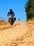
Heading north the road appears to have been graded recently – but the loose sand was just left with a steep ridge in the middle of the road and had blown across the rest of the road. Bother. Sand messes with my head. I should have turned back after the first wobble. I really should have turned back after buying a plot.
mode
Managed to get the bike upright – a first for me, I’ve always had help before (see Warren – it can be done, even by an unfit and over-fed middle-aged duffer). Really hot now - temperature gauge now reads 37 degrees. Set off again, determined to master this loose stuff – and managing; actually feeling like I might make it to Jurg se Kaya in a few weeks. Reasoning failure number plenty: over-confidence.
Got through to the Tankwa river crossing carefully (determined not to do a Bob Goode or a Leon Lee) and had a rest. Road looks ok going ahead. I should have banked the success so far and taken the short route back to the R355. Carried on north instead.
Going through gate number lots, the road splits and the Garmin indicates the right hand fork. I take it and the track gets very interesting. A couple of sandy and pebbly patches, worn away and rough, but not the worst I’ve been on though. Now the Garmin says turn left, through a fence, no obvious road. The track carries on straight and then bears to the left. Ok I think, it’s a slight detour and we’ll get back on route soon. The track sort of runs parallel to the route on the Garmin – so I’ll follow on. And then it crosses a dried pan – and disappears.
I find it on the other side, and it seems to follow the Garmin route. Ride past abandoned farmhouses and come to a locked gate. Turn back.
Garmin says ‘Off Route. Recalculate?’ And then I made a serious reasoning failure, being new to GPS devices, I thought ‘what the heck?’ and pressed yes. The route calculated – and seemed to head back on the track I’d come on – but veered off a bit later and the track started getting better, much better. And then it got worse. And then it crossed a dry river bed.
I can see why there are reports of people following their GPS devices into canals and the like – because it is quite a seductive thought. This thing knows exactly where I am. I can vaguely point to an area on a map. It’s found an alternative route out of here. It ‘knows’ more than I do. I’ll follow it. Across the dry river – which is actually quite soft. Very soft. Get really stuck soft.
By now it was about 15h00, the wind was really whipping up the loose sand – which I was making looser with every struggling step. Take everything off the bike and try and dig a path through, just get stuck deeper. Battled for about an hour and a half and then stopped to consider my options. My eyes were streaming from the sand lodged under my contact lenses. I think I may have strained something, vision in the right eye was getting worse and worse.
Now I reach for my cellphone, thinking I may have to walk a bit to get a signal. Major reasoning failure – I should have checked coverage areas and known it would be completely useless. That should have informed many of my earlier decisions. But cell-coverage is so ubiquitous in my life that I hadn’t even considered it. After all, on the way back from Sutherland, when Graham had a wrecked tyre he managed to get cellphone reception by walking up a hill.
Sat down, felt sorry for myself, and considered my options: Walk back 25km to the last farmhouse I saw? Pitch the tent and stay overnight and hope for better strength and ideas and no wind in the morning? Wait for help? Only 500ml of water and a couple of 250ml juice boxes left. Unlikely for anyone to come that way in a long time – this was really a track, with no signs of being recently used. Walk to the R355? GPS shows that to be about 10km directly east, GPS and map also show a location called ‘Die Bos’ slightly north of that 14km away.
So, after recording my position on the GPS, I walked to the R355, sun setting at my back. About 4 hours later I made it to the R355 and celebrated by drinking my last few drops of water. Damn my feet hurt – even the blisters have blisters. Motorcycle boots are not really made for hiking (but I’d discarded the idea of stumbling across rough terrain in my takkies - with the potential of snakes, ticks etc.)
No cars. Walked north to get to Die Bos. No signs of life. Die Bos is just a couple of abandoned farm houses. Waited another hour by the side of the road – and then lay down in one of the abandoned houses feeling sorry for myself. Woke up to screaming at about 02h00 – heart pounding I realise it’s just a troop of baboons. The screeching continued sporadically for several hours, I woke once to the sound of a vehicle passing at about 04h00. Damn.
 Sunrise above my noisy overnight stop
After sunrise I waited by the side of the road for about an hour and a half, and finally a car came past. Fully laden, they wouldn’t take me anywhere – but they did have some water (I was parched); and they did say there was a farmhouse about 3km further up the road. I walked on – and a farmer came past with some labourers about half an hour later. Jaco van Baalen took me back to the farmhouse where he stays with his father Johan – made me some coffee and let me use the phone. Called BMW Insurance – they said they’d try and find someone to help. Finally they called back and said they’d have to get someone from Kimberly – no-one near had any vehicles capable of helping off-road. Johan said they’d help – sent his tractor out with a handful of labourers. Fortunately we didn’t need the tractor – enough hands managed to lift me out of the loose sand. Ironically we came in to the bike on the track that the GPS had calculated. If only I’d managed to get through the soft sand ...
I abandoned my original route plans and headed directly north to Augrabies on the R27. With my legs aching, and feet blistered, any thoughts of gravel travel were abandoned. The only thing that kept me awake on that road was the significant number of stop/go repairs.
They say that what doesn’t kill you makes you stronger. I don’t know about that, but it certainly makes for a learning experience.
So, if you travel north on the R355 about 3km past a spot called Die Bos, at the farm Swellendam on the left-hand side – please give a friendly wave to Johan and Jaco van Baalen, to whom I am really, really grateful.
- 3334 reads
Comments
Hi Kevin. Do you perhaps have gps tracks for this route? Or would you mind sharing the planned route for the first couple of days?
Hi Dirk,
Unfortunately - when I returned form the trip I found I only had 1 weeks worth of tracks. I need to find the setting to keep these for longer. I was quite disappointed to find I'd lost the recalculated and 'hike' part of my trip.
PM me your email address and I'll send you the first couple of days routes - with a rough idea of where the locked gate was. But: don't follow me - I'm lost!
Wow Kevin,
Talk about learning lessons.
Won't even start to list them.
However, as we all know, it's hardly about the destination, it's the journey that makes the trip.
Nice photos.
I see you load a lot of gear for a 10 day trip. That's more than you need.
Irecently did that road bac between Kenhardt & Calvinia, and the ladies at the control posts allowed - Die man met die skoeter- to pass through all points if I road on the ribbon the contractor were working.
I rode that route with tops to keep awake.
So how'd the rest of the trip go?
I've been to Die Mond - once. In my rock-climbing days. Took Julie and the kids (3 year old and a baby then). Went in our '4x4' citi-golf. Got a puncture, had no jack so lifted the car by hand and used rocks.
It was so hot the owners of the camping site had gone North to where it was cooler. We had to climb between 4am and 6am, then float back to the camping site in the river because it was too hot to walk.
Nice little adventure though Kevin, and thanks for sharing. Hindsight is one thing, but what's the bet that if you end up in a similar situation again your choices would be the same. Especially because you will now be saying 'this is no worse than Die Mond, and I came out of that OK'  .
.
you shouldn't have blipped in that river bed!
Pete - I think you are confusing him with Kevin (the blipper) van Blerk. This is Kevin Charlston. I believe both of them will be on the West Coast trip this weekend, so I will have a good look at the differences between them... 
Wow, our very own Bear Grylls!
Well done on remaining calm(ish) and managing to extricate yourself without too much damage - only a few blisters and a bad night's sleep.
Kevin, was your intention to retrace the route "in" after turning around at the locked gate? If yes, then pressing recalculate was probably not the right option. If you merely wanted to find a way "around" the locked gate and continue to your destination then the recalculate may have been the right option.
Note to self - when riding alone take lots of water.
Wow! What a trip! Thanks for sharing and glad you are OK.
My dad always says you build character during hard times - sure your's must be exellent by now!! 
Thanks Andy - the rest of the trip wasn;t particulalrly exciting and some of it has been reported elsewhere.
Camped at Augrabies. Nice campsite – spoilt by millions of midges, particularly around the falls themselves.
Day 3: N14 through Upington all the way to Tlokwe (Potch). Mostly good road – just very boring; but my feet were still messed up and I tossed my original plan (via Bloemhof dam).
Day 4, 5 & 6: Business & family obligations in Johannesburg.
Day 7: Johannesburg to Golden Gate, via Vredefort (to see the Dome natural heritage site), Heilbron, Reitz, Kestell. Camping overnight. Mostly good roads – but the stretch from Reitz to Kestell had a lot of potholes.
Day 8: Golden Gate to Graaf Reinet, via Clarens (really beautiful), Ficksburg, Zastron, Aliwail North, Middelburg. Roads mostly good – but badly potholed in patches, particularly on the R26 between Wepener and Zastron.
Day 9: Nieu Bethesda to Sutherland (described here: http://www.bmwmotorcycleclubcape.co.za/graaf-reinet-richmond-nieu-bethes...).
Day 10: Sutherland to Cape Town down the Ouberg pass. Stunning – but damn steep. I got a puncture, and managed to fix it (another first!). At this point I realised I’d put my Camelbak down on the bike and not worn it – and it was nowhere to be found. Middle of nowhere, no water, memories of thirst from day 1.
I decided to cut back to the closest tar via Amandelnek to the R354, and thought I’d get some water and breakfast in Touwsrivier and then cut through to Robertson on gravel. The Touwsrivier quickstop is in the middle of renovations, and the shop is a cramped container. No food.
I’m not a suspicious man, but I’d had 3 strikes (tyre, water, breakfast) and thought “enough”. Stayed on the N1 all the way home, stopping in Worcester for brunch.
Tony: I'd intended to follow the breadcrumbs back to the Tankwa river, so in that sense, recalculating was wrong. However that doesn't mean the device was wrong - just my use of the options avaliable. Given that I'd already been diverted from the planned route, and that I'd followed the route to a locked gate - the choice of recalculating was not wise. The device was right - I just should not have taken that option.
One of the big mistakes was only getting my first Garmin 2 weeks before a long trip. I trusted my technical understanding to get me through; but technical ability does not always translate to wise decisions.
Archived Tracks: Thanks for your suggestion today Tony.
Plugging the GPS into the PC and browsing the file structures, I found a GPX\Archive folder with a number of .gpx files in them.
In BaseCamp I imported these files (can only be done one-by-one) and they contained the tracks. It's a weird relationship through - some if the tracks for a day were spread across multiple archive files.
Glad it works similar to the Z660.
I still have not figured out how these files are created/named. It's all a bit confusing, but at least the data is all there :)
One thing I always do when planning a trip on roads or tracks that I haven't ridden before is to open my route in Google Earth and study it in some detail. I turn the route flat and go over it again as well, as if I was flying just above it.
This gives me an idea of landmarks to look out for and I write these down. An example would be, " the right turn I need to take is just after a small bunch of trees next to dam and farm house". Some times the imagery on Google Earth is so good I feel like it's my second time there where I finally get there.
I also Google articles etc on the route I want to take as one usually finds some fairly detailed accounts of travelers before you, with pictures.
This method is obviously not as usefull as a good old recce ride, where you find all this stuff out first hand (as you have done), but it is invaluable when time does not permit a recce ride, and I think can help with the planning of any trip.


